


Post processed kinematic (PPK) is a GPS correction technology used in surveying that corrects the location data after it is collected and uploaded.
Real-time kinematic (RTK) is another type of correction technology like PPK but performs real-time corrections to the data and images. PPK technique is commonly used in drone mapping and land surveying.

PPK techniques effectively capture accurate location information as an alternative for traditional methods, i.e., ground control points (GCP).
This article discusses the working and benefits of PPK surveying in the construction industry.
Working of PPK Surveying
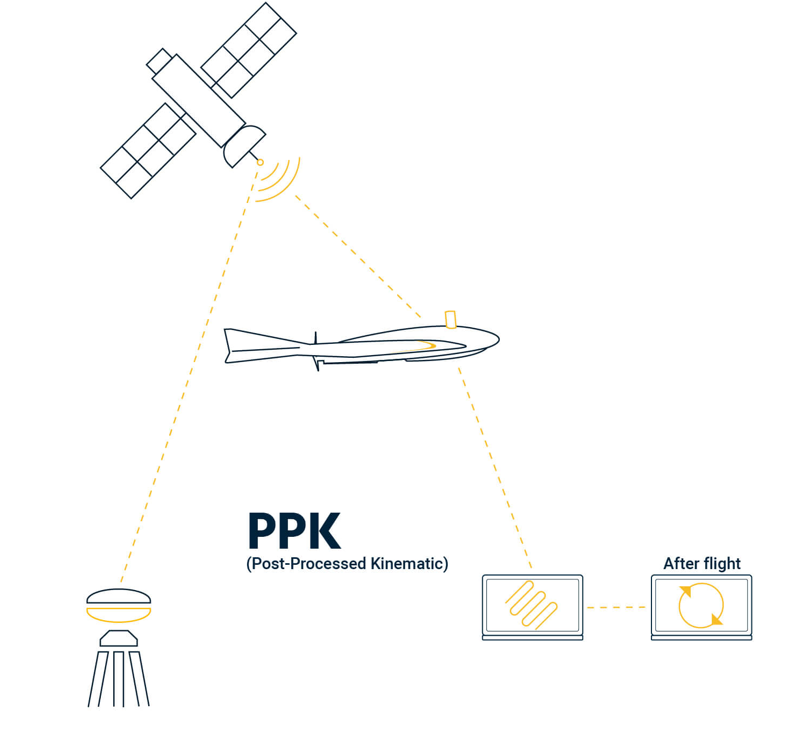
PPK surveying requires at least two Global Navigation Satellite System (GNSS) receiver units to achieve cm-level accuracy of measurements. One unit is static, which is the reference receiver called the “base,” and the other is a moving receiver called the “rover.” More than one receiver can be used for this survey.
During the workflow, the base station and the rover units record raw GNSS data. This raw data contains all observations without any calculations. While doing so, there is no need for a stable connection between the rover and the base station.
The data collected is stored in the survey controller or recipient until the fieldwork is completed. This data is later processed using software, and the corrections are applied to the data.
In new drone mapping technologies, PPK-enabled drones are used, which act as PPK receivers. With the help of PPK, these drones take numerous geotagged images of the areas over multiple passes.
Features of PPK Surveying
- PPK surveying reduces the need for ground control points (GCP), saving field preparation time.
- In PPK, the rover moves and collects the location coordinates without bothering about its connection with the base station. Hence, the technique allows having longer baselines of up to 100 km.
- As there is no requirement to have a linked connection between the rover and the base station, the method is suitable for survey areas with obstructions like trees, buildings, etc.
- PPK surveys are used for mapping or surveying the points where several centimeters of precision are needed, such as:
- Recording the locations of sample sites
- Mapping out a feature, for e.g. shorelines
- Measuring the positions of markers, for e.g. points on glaciers
Advantages of PPK Surveys
- PPK data recording time at the site is quicker than RTK’s real-time recording because main calculations and error corrections are performed post-survey.
- The PPK system does not require the surveying team to maintain the connection between the base station and rovers.
- It is more flexible and can be employed in more challenging environments.
Even though the PPK survey is performed quickly, it demands more time to post the data and implement GPS corrections.
FAQs
Post processed kinematic (PPK) is a GPS correction technology used in surveying that corrects the location data after it is collected and uploaded.
Post processed kinematic (PPK) is a GPS correction technology used in surveying that corrects the location data after it is collected and uploaded. Real-time kinematic (RTK) is another type of correction technology like PPK but performs real-time corrections to the data and images.
Read More